Our clients, who have limited and spotty data on agricultural water use, can use our online dashboard with credible and up-to-date information on water use and related indicators. They can better monitor and manage water withdrawals and respond to requests from farmers and local governments.
Our dashboard is a unique proposition because complex geo data are translated in an affordable, time-saving and user-friendly way. The tangible information can be directly used for reporting, decision-making and planning.
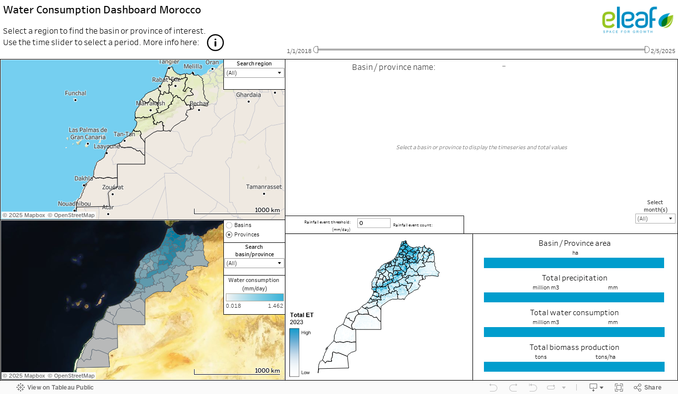
Please see our demo version below.
- Select your area of interest from basin, province, commune to field level
- Explore long-term actual evapotranspiration data at spatial and temporal scales not available in other datasets (2009-present)
- Import, exchange and export data and figures for communication with partners, authorities and water users
- Quickly overview consumed water volumes in your selected period and area of interest