
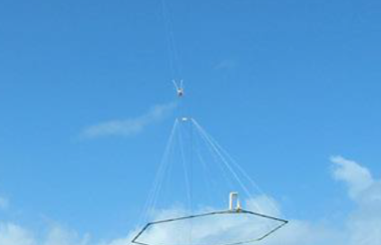
The study focused on conducting helicopter-borne electromagnetic and magnetic surveys. These investigations allowed for the creation of a modern geophysical data infrastructure, significantly improving the geological and hydrogeological understanding of the upstream perimeter of the Aïn Abaïnou spring. They provided a more precise view of the nature, geometry, and lateral and vertical extent of the aquifer layers present in the area.

The results also enabled the development of a geological model of the aquifer system, representing a crucial step in preparing a future hydrogeological simulation model to support sustainable water resource management. The investigations primarily targeted the Plio-Quaternary alluvial and sandstone formations, the Eocene phosphate limestones, and the Turonian dolomitic limestones, with these aquifer layers separated by Senonian marls of variable thickness.
In addition, the electromagnetic and magnetic surveys allowed for the identification of paleochannels and fracture lines within the study area. The area covers approximately 500 km², and the program included around 2,000 km of helicopter-borne survey profiles, with a minimum investigation depth of 300 m, reaching up to 800 m. The measurement systems implemented were selected for their resolution and penetration capacity, with their relevance supported by operational references in similar geological contexts.